01. GIS & Remote Sensing Applications
Land Use / Land Cover Assessment – IGGL, Northeast India
Satellite Remote Sensing and GIS-based LULC assessment incorporating project-area mapping, Sentinel-2 data interpretation, thematic classification and quantitative land-cover analysis.


02. Hydrology, Watershed & Flood Modelling
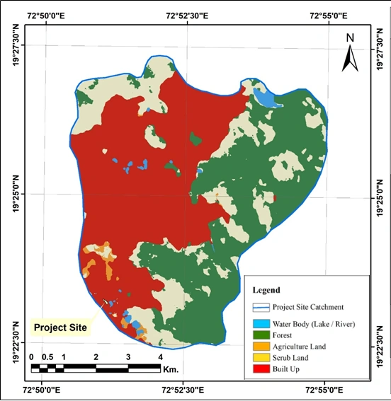
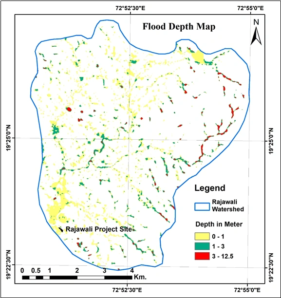
Hydrology & Flood-Risk Assessment – Rajawali, Vasai, Palghar
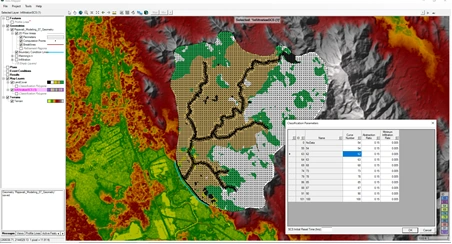
Integrated hydrological and flood-risk assessment using DEM-based catchment delineation, Land Use/Land Cover analysis, SCS Curve Number methodology and rainfall-runoff modelling to evaluate drainage characteristics and potential flood inundation.

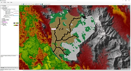
HEC-RAS 2D Rainfall–Runoff & Flood Modelling
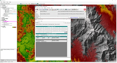
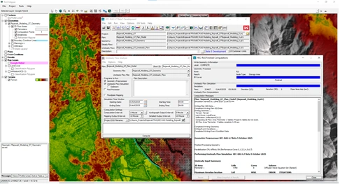
HEC-RAS 2D rain-on-grid modelling incorporating terrain data, land-cover characteristics, surface roughness and rainfall inputs to simulate overland flow, drainage response and spatial variation in flood depth.
HEC-RAS Model Setup for Hydrology & Flood-Risk Assessment


HEC-RAS 2D Model Simulation for Hydrology & Flood-Risk Assessment
03. Hydrogeology & Water Resources
Hydrogeology study of Pune Ring Road
Hydrogeological assessment of the proposed Pune Ring Road (Eastern Alignment), integrating geological, geomorphological and groundwater prospect mapping using satellite remote sensing and GIS to evaluate subsurface conditions, groundwater potential and hydrogeological characteristics along the proposed infrastructure corridor.


4. Geology, Geomorphology & Hydrology
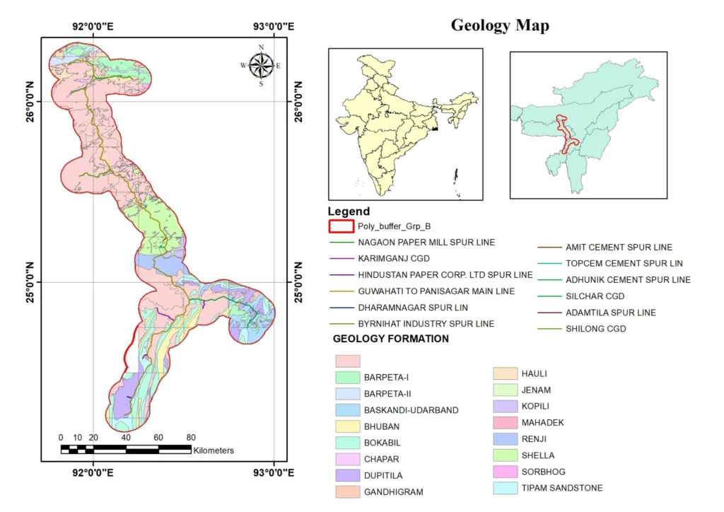
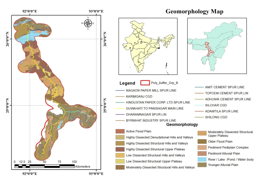
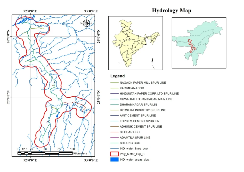
Geology, Geomorphology & Hydrological Assessment – IGGL Northeast India Project
Integrated geological, geomorphological and hydrological mapping using satellite remote sensing and GIS to characterize geological formations, terrain features and drainage networks along the proposed pipeline corridor. The assessment also incorporates geological hazard mapping, including earthquake and landslide occurrences, to support infrastructure planning and environmental risk assessment.
5. Ecology, Biodiversity & Green Belt Development
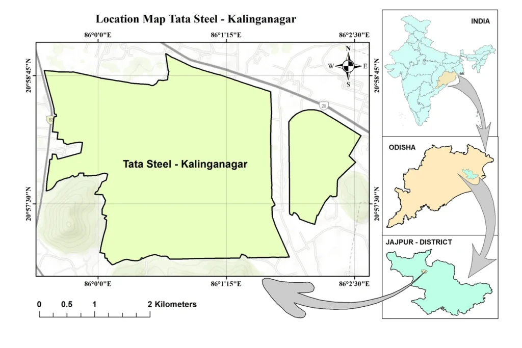
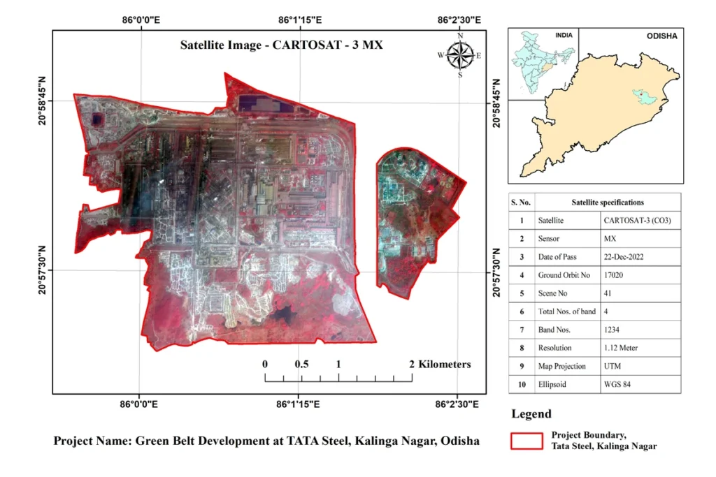
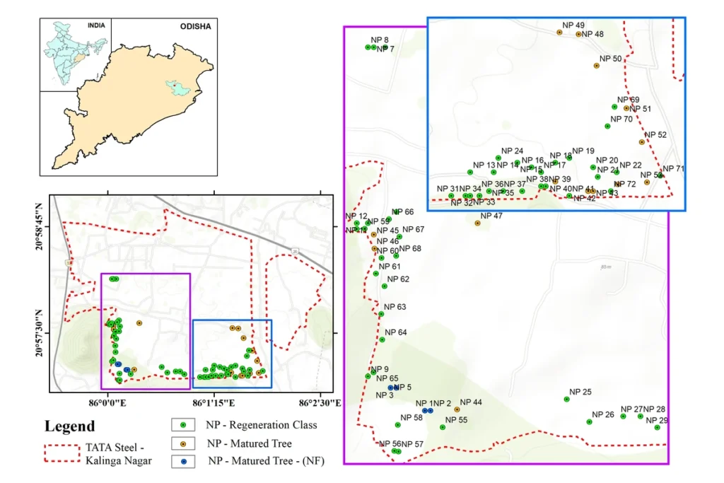
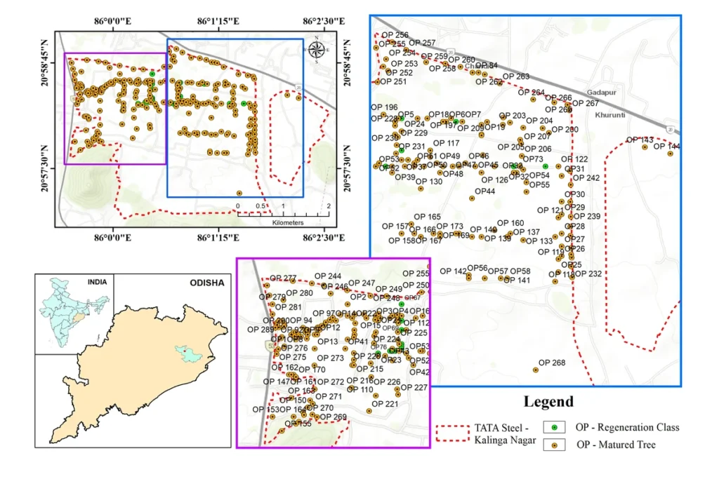
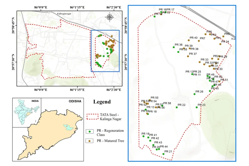
Ecology, Biodiversity & Green Belt Development – Tata Steel, Kalinganagar, Odisha
Satellite Remote Sensing and GIS-based assessment of green belt development at Tata Steel, Kalinganagar, Odisha, integrating high-resolution CARTOSAT-3 MX satellite imagery, land use/land cover mapping and spatial analysis of plantation areas. The study includes mapping of existing and newly developed plantations, residential plantation plots and green belt distribution to support vegetation monitoring, ecological planning and industrial environmental management.

6. Coastal & Wetland Studies – Drone Survey, Terrain Modelling & Mangrove Mapping
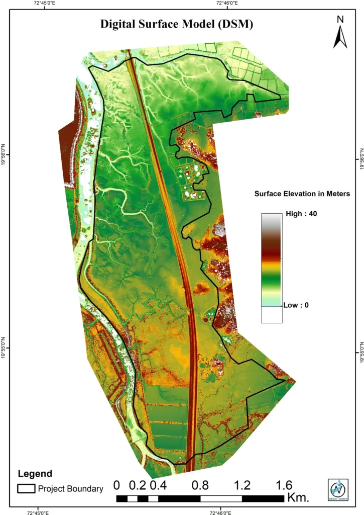
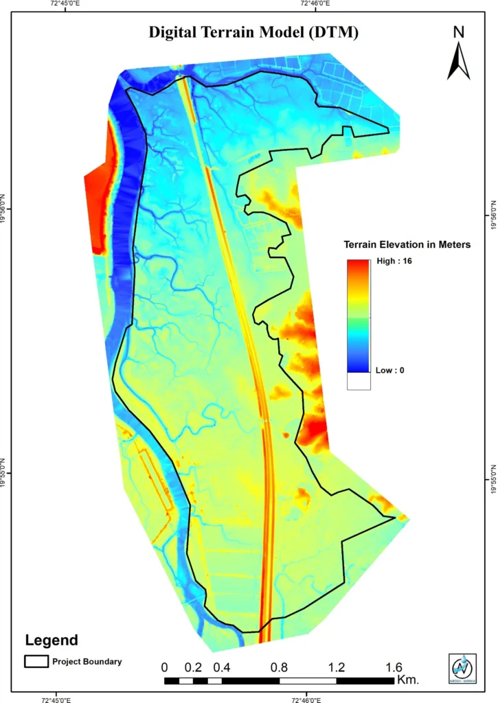
Drone-Based Coastal, Wetland & Mangrove Assessment – Dahanu, Palghar, Maharashtra
High-resolution drone-based geospatial assessment of coastal wetlands and mangrove habitats at Dahanu, Palghar District, Maharashtra. The study integrates UAV-derived orthophoto mosaics, Digital Surface Models (DSM), Digital Terrain Models (DTM) and GIS-based mangrove patch mapping to characterize coastal topography, terrain elevations, wetland features and mangrove distribution. The generated spatial datasets support coastal environmental assessment, wetland monitoring, mangrove conservation and sustainable coastal-zone planning.


7. Environmental Assessment & Infrastructure Planning
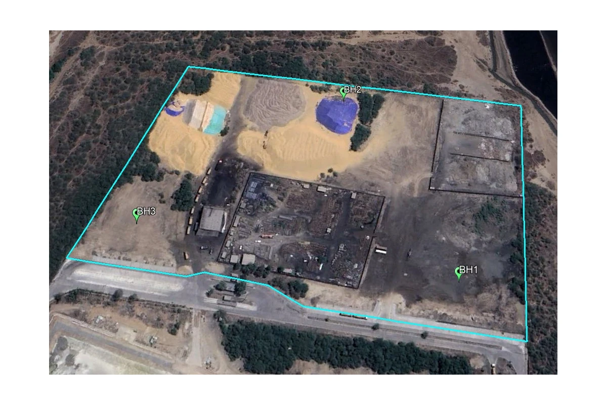
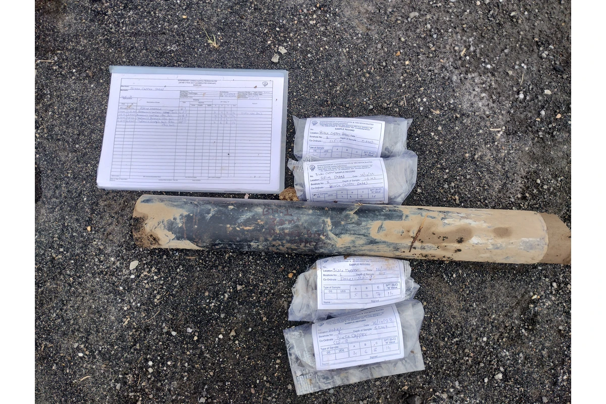
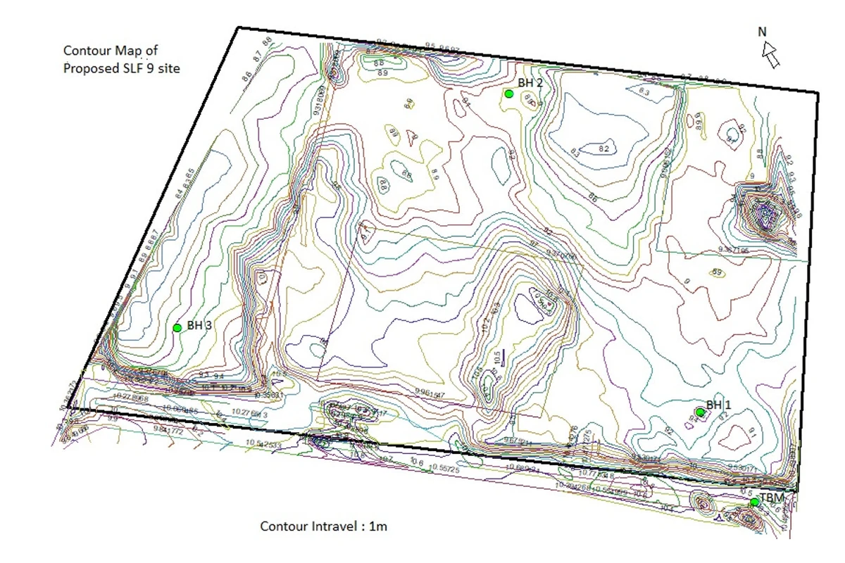
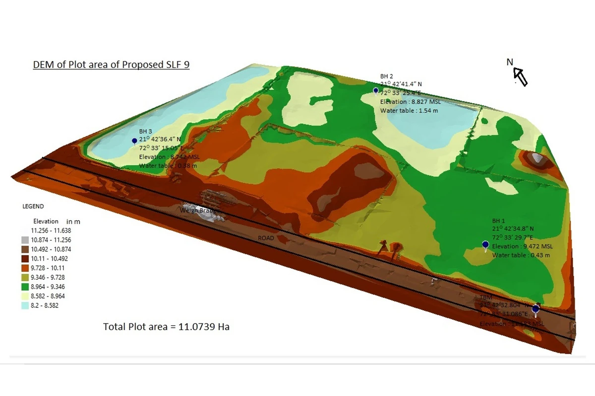
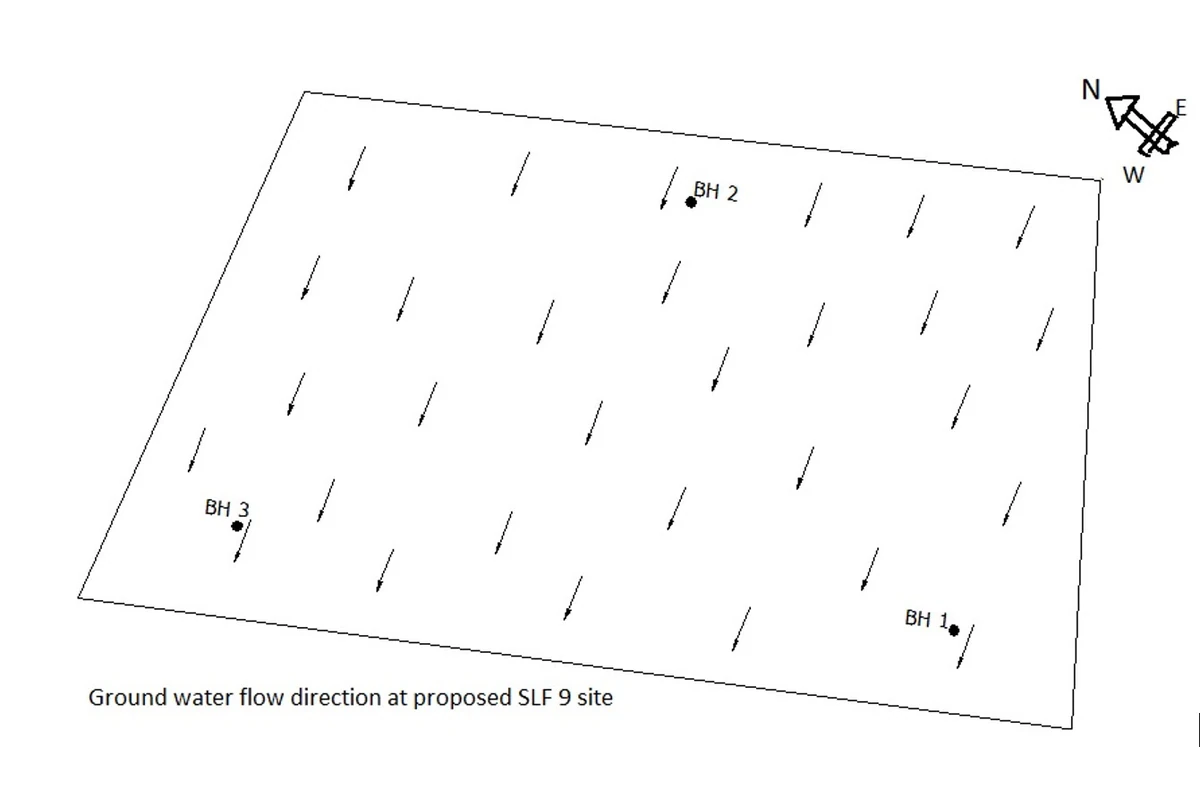
SLF-9 Design & Environmental Engineering Assessment – HINDALCO, Dahej, Gujarat
Geotechnical Investigation | Hydrogeological Assessment | Topographic Survey | DEM & Contour Mapping | Groundwater Flow Analysis | Engineering Design
Integrated geotechnical, hydrogeological and topographic assessment supporting the planning and engineering design of the SLF-9 facility at HINDALCO, Dahej, Gujarat. The study incorporated borehole investigations, geological core sampling, groundwater-level assessment, groundwater flow-direction analysis, topographic and contour surveys, and Digital Elevation Model (DEM) generation. These investigations provided essential subsurface, terrain and groundwater information for site evaluation, engineering design and environmental planning.

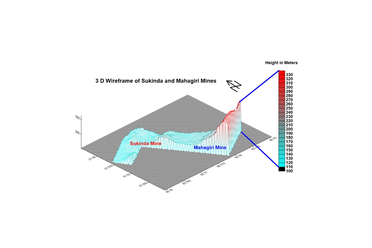
Mine Drainage, Hydrological Assessment & Stormwater Management – Sukinda & Mahagiri Mines, Jajpur, Odisha
3D Terrain Modelling | Slope & Contour Analysis | Catchment Delineation | Garland Drain Design | Sump & Detention Pond Planning
3D Terrain Modelling | Slope & Contour Analysis | Catchment Delineation | Garland Drain Design | Sump & Detention Pond Planning
Integrated hydrological and terrain-based assessment of Sukinda and Mahagiri Mines, Jajpur, Odisha, incorporating 3D terrain wireframe modelling, elevation contour mapping, slope-direction analysis and sub-catchment delineation. The study included mine garland drain layout and design, along with proposed sump and detention pond locations, to support surface runoff management, mine drainage planning and environmental protection within the mining areas.